Earth observation satellites make it possible to monitor phenomena such as forest fires, droughts and heat waves from space. The Copernicus Climate Change Service reported exceptional temperatures: June 2026 was the second warmest June globally, whilst Western Europe experienced its warmest June on record.
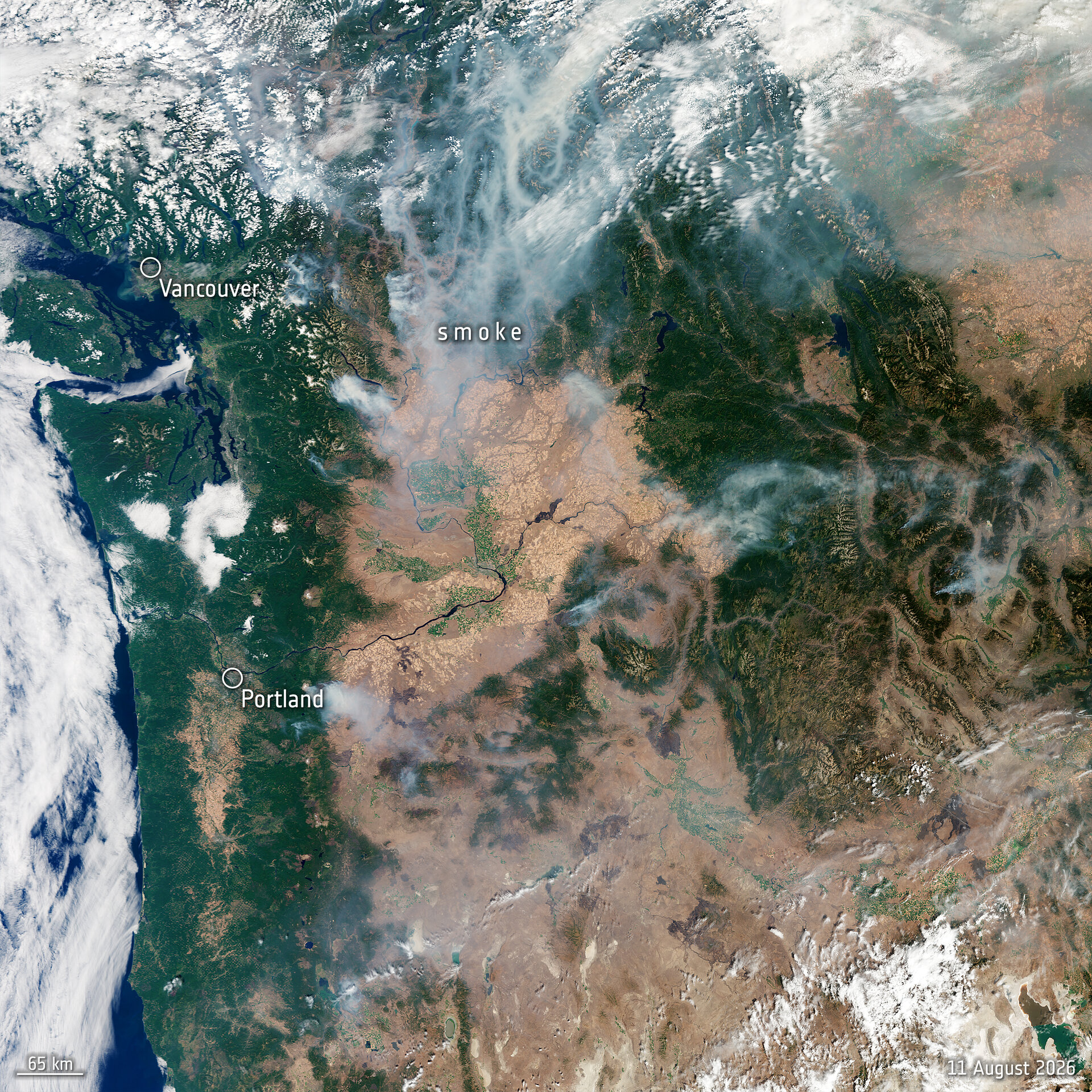
Although fires can be caused by human negligence, such as discarded cigarette butts, or by natural causes like lightning, high temperatures combined with lack of rainfall, low soil moisture and strong winds have created optimal conditions for forest fires. It is estimated that up to 35% of greenhouse gases are generated by the burning of organic matter in forests, shrubland and grassland, according to climate change reports.
Since 1 May 2026, the Copernicus Emergency Management Service (CEMS) has been activated more than 30 times to provide data and images of forest fires in Croatia, France, Germany, Greece, Greenland, Italy, Poland, Portugal, Spain, Tunisia and the United Kingdom. The Copernicus Sentinel-2 satellites capture high-resolution images in 13 spectral bands, which makes it possible to monitor vegetation in true colour and collect infrared data showing heat areas.
Copernicus Sentinel-3 provides useful data on land and sea through its Ocean and Land Colour Instrument (OLCI) and its Sea and Land Surface Temperature Radiometer (SLSTR). Copernicus Sentinel-5P measures trace gases and aerosols emitted in large quantities by forest fires that affect regional air quality.
ESA's EarthCARE can also highlight active fires and smoke columns with its multispectral imager, whilst its advanced lidar is used to characterise emissions such as smoke.