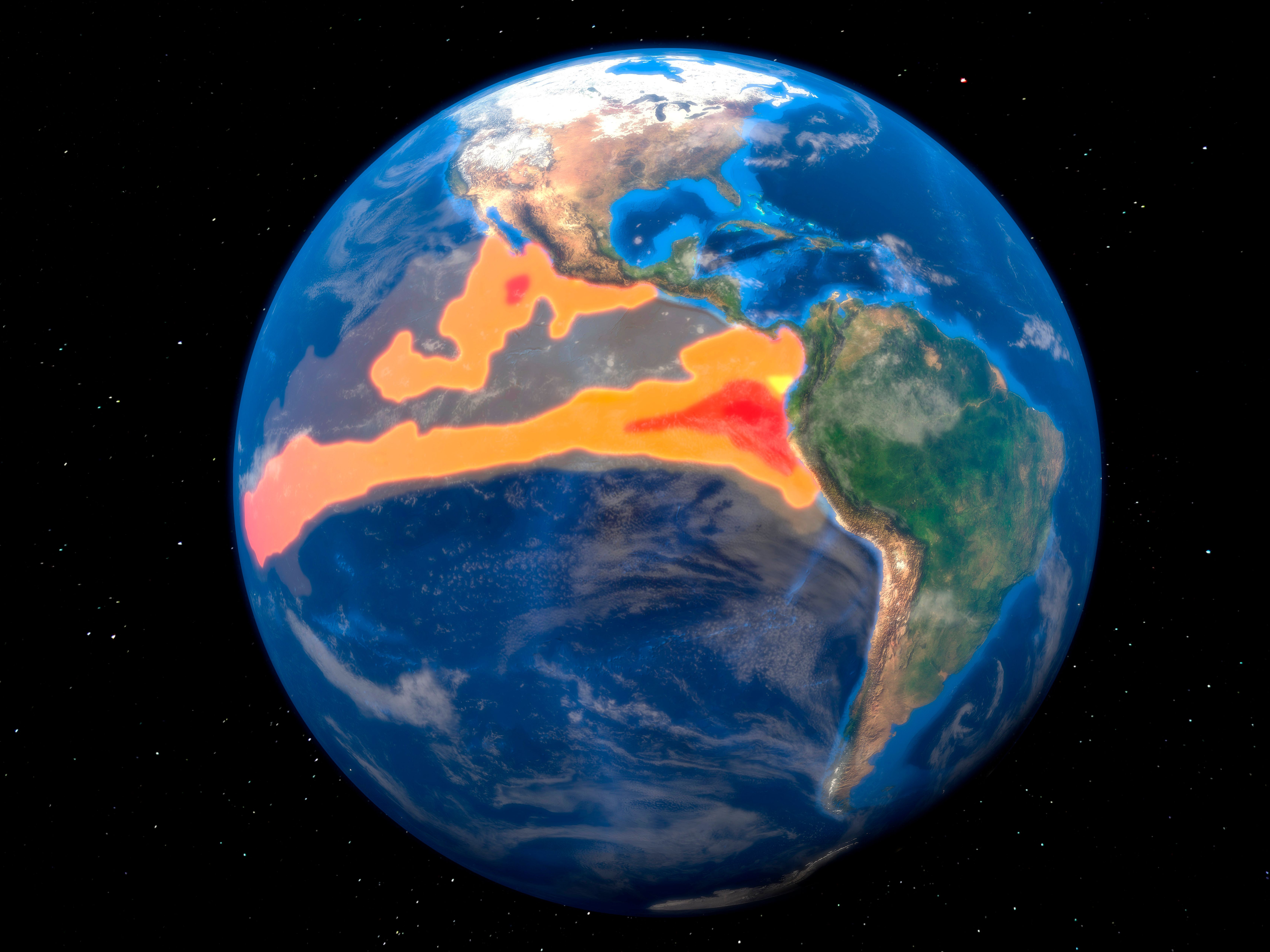
El Niño, characterized by warmer-than-normal sea surface temperatures in the equatorial Pacific, occurs every few years and is being closely monitored by meteorological agencies worldwide. The phenomenon is drawing heightened attention this year because the current event has strengthened at an exceptional speed, according to researchers, and may reach an intensity unprecedented in recorded history.
El Niño is officially declared when sea surface temperatures in the Niño 3.4 region of the eastern-central tropical Pacific rise 0.5 degrees Celsius above normal for three overlapping three-month periods, according to the U.S. National Oceanic and Atmospheric Administration. Other weather agencies use slightly different criteria and regions to make their determinations. Along with warmer oceans, the phenomenon involves a weakening of trade winds that normally blow from east to west, allowing seawater to accumulate on the eastern side of the Pacific.
The effects of El Niño ripple across the globe. When heat stored in the ocean releases into the atmosphere, it triggers shifts in rainfall, temperatures, and hurricane activity worldwide. The Southwest is likely to see increased winter precipitation, while the Pacific Northwest typically experiences reduced rainfall. Indonesia and parts of southern Africa face an increased drought risk, and Atlantic hurricane seasons tend to be milder. Winter temperatures often rise in Japan, parts of Australia, and Brazil.
Scientists use the term "super El Niño" informally to describe events where temperatures rise at least 2 degrees Celsius above average. Modeling by Berkeley Earth shows that median temperatures for the Niño 3.4 region could reach 3.6 degrees Celsius above normal—even accounting for long-term global warming effects. This would exceed the record set during the 2015–16 El Niño by approximately 0.8 degrees Celsius, a significant margin given that the difference between the strongest and fifth-strongest El Niño events over the past 150 years was only about 0.5 degrees Celsius.
Previous super El Niños have caused substantial disruptions. In 1982–83, record snowfall in the Colorado River Basin, combined with spring warmth and rainfall, caused the river's flow to exceed 1.5 times its average, leading to emergency dam releases and overflow from the Hoover Dam spillway for the first time in roughly 40 years. The 1997–98 event brought Indonesia's worst drought in half a century, while the 2023–24 super El Niño contributed to southern Africa's worst drought in over 100 years, leaving approximately 61 million people in need of humanitarian aid. NOAA estimates a greater than 90 percent probability that this El Niño will become "very strong" during the coming fall and winter.